Today we had a short overview of the study at the Irish Research Transport Network Conference. Our talk included the design and scope of the project, but we’ve also snuck our first GPS data snippets.
We’ve been working on our wealth of GPS data, and while we are working on the anonymisation, we can share an exciting nibbles. In this GPS heat map, you can see this strange pattern. Why are people choosing to bike these ways, and not the route marked in red?
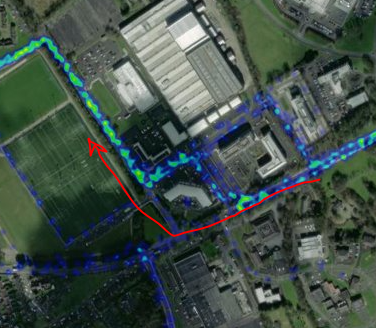
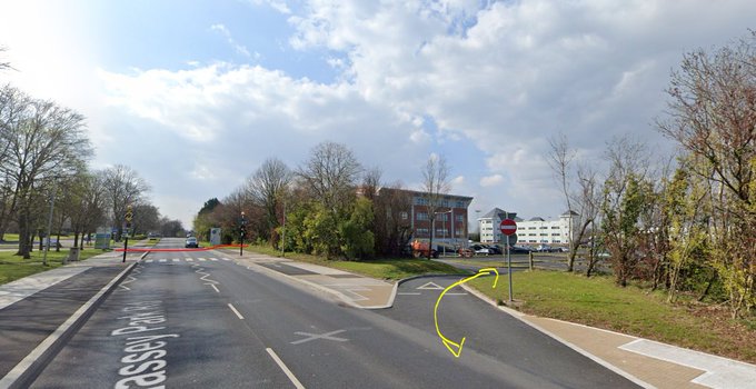
And the answer is: Because the new IDA cycle lanes end abruptly, so people are cutting through the technology park carpark, rather than spilling out onto a 60km/h road!
We are also working to identify where people are parking on campus, in the city, and at suburban shops, to identify where there is unmet parking demand, and also looking at what routes are popular , both those that have cycle infrastructure and those that don’t. Stay tuned!